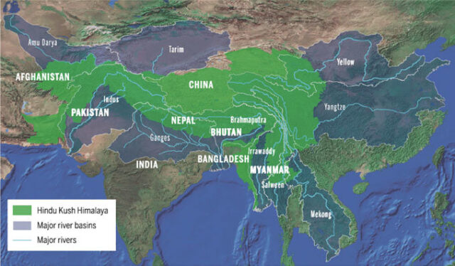
Bangladesh had requested three types of information from India regarding flood forecasts. Firstly, data on how much rainfall is occurring upstream in the shared rivers, and the rate at which this water is flowing downstream. Secondly, a prediction of rainfall and the rate of water increase for the next three days. Thirdly, information on when the 60 dams on the Indian side of rivers upstream of Bangladesh will be opened and how much water might flow downstream from them.
During the last week of August last year, Bangladesh requested this information at a meeting of the Joint River Commission of Bangladesh and India. Despite multiple follow-up letters requesting the same information, India did not respond.
India only provides data on the water levels at 14 points of the shared rivers. However, Bangladesh had requested detailed information from 28 points. Under the 1972 Joint Commission Agreement, Bangladesh receives this single piece of information twice daily. With 92% of Bangladesh’s floodwaters coming from upstream flow, without detailed knowledge of the volume, speed, and duration of the upstream water, it is impossible to provide an accurate flood forecast.
A meeting was held yesterday, Sunday, at the Ministry of Water Resources, with experts from the Flood Forecasting and Warning Center. This meeting discussed flood forecasts for Feni and Comilla and decided to request more detailed information from India regarding flood forecasts. A meeting of the Joint River Commission, initially scheduled for this month, may now be held in September or October. Before that meeting, instructions were given to request information on the water levels of the shared rivers.
When asked about this, Syeda Rizwana Hasan, an advisor to the Ministry of Water Resources, told Prothom Alo, “We need more detailed information from India for flood forecasting and management. We have discussed with experts how we can obtain this information. We will formally request this data from India soon.”
One Piece of Data is Not Enough
In August last year, a presentation was made to the Joint River Commission on behalf of the Flood Forecasting and Warning Center. It stated that India is providing data twice a day on the water levels at 14 points on rivers upstream of Bangladesh. However, since 1972, this information has not been sufficient for flood forecasting. Bangladesh needs detailed data from at least 28 points. Receiving water and rainfall data from the upstream of these shared rivers only twice a day is not enough. Bangladesh needs real-time data to prepare for sudden rain and floods. Information on where the floodwaters will come from, in what quantity, and at what height is needed at least three days in advance.
The 14 points from which Bangladesh receives information are four on the Brahmaputra, one each on the Dharla and Dudhkumar, four on the Teesta, three on the Ganges, and one on the Meghna. However, Bangladesh has requested detailed information from a total of 28 points, including four more on the Brahmaputra, two more on the Teesta, seven more on the Ganges, and three more on the Meghna.
The written submission to India from Bangladesh stated that during flash floods, water from border rivers rapidly flows in over a short period, causing significant damage to lives, livelihoods, and property in Bangladesh. This is particularly true for the Teesta, Manu, Khowai, Muhuri, and Feni rivers because these rivers are close to Bangladesh’s border, and water quickly enters Bangladesh. Abul Hossain, a member of the Joint River Commission, told Prothom Alo, “We have asked India for flood and rainfall data at several meetings. We also need to know the geomorphology of the border rivers. Information on the locations of the dams, their water-holding capacity, and when the gates will be opened is also necessary. Without this information, it is difficult to provide accurate flood forecasts. That’s why we will formally request detailed information again.”
In the latest meeting of the Joint River Commission, the infrastructure built on rivers in the Indian part was also discussed. If information is available on the release of water from the dams, Bangladesh can take emergency measures to protect lives, livelihoods, and infrastructure. In this case, forecasts should be provided five days in advance. Even if Bangladesh receives this information at least two days in advance, emergency measures can be taken to handle the situation.
Lack of Minimum Data on Eastern Rivers
Compared to Bangladesh’s Padma, Meghna, and Brahmaputra rivers, the water in the Barak, Manu, Gomti, Khowai, and Muhuri rivers flows faster. It is challenging to predict floods in these rivers without accurate and detailed information. These rivers flow through narrow and uneven paths, and because there are hills upstream, water quickly flows downstream. As a result, everything is swept away by the floodwaters before any preparations can be made. For the Barak, Muhuri, and Gomti rivers, Bangladesh has said it needs the necessary data from India at least a day in advance to provide a forecast.
Bangladesh does not receive even the minimum information from India regarding the eastern rivers like the Muhuri and Khowai. This makes it difficult to prepare for floods and disasters. The embankments and drainage infrastructure in these areas are controlled by the Bangladesh Water Development Board. Sudden floods make it difficult to manage this infrastructure.
Ainun Nishat, a former member of the Joint River Commission and an emeritus professor at BRAC University, told Prothom Alo, “Regional cooperation is being emphasized worldwide for flood management. For a downstream country like Bangladesh, working with all the upstream countries is crucial. We need to know about water flows from Nepal, Bhutan, and India. We need to move toward basin-based management.”


